Here's what we've found so far..
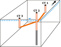
Only one well (CT 2) was successfully drilled through the fault and into the underlying shale. Wells CT 1 and CT 3 encountered ~6 ft and ~7 ft caves, respectively, which resulted in the termination of drilling.
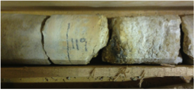
Rock chips were collected from CT 1 and CT 2, and rock core was collected from CT 3. The dolostone ranged from pale pink, grey to buff coloured. In CT1 and CT 2, there was a distinct transition from the dolostone to the shale. The shale was dark grey with numerous white veins.
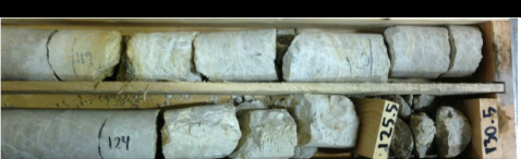
In CT 2 and CT 3, there is a noticeable change in colour of the dolostone at ~120 ft. The rock at this depth is bright orange with dense white fractures and extremely crumbly. There was an apparent hydraulic connection between CT 1 and CT 2 at ~120 ft. The distinct change in colour and texture, along with the hydraulic connection, suggests that there may be a continuous fracture or fault at this depth that connects all three wells.
Groundwater Seeps
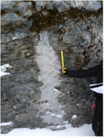
Approximately 1 km of the Champlain Thrust is exposed on the eastern shore of Lake Champlain, Lone Rock Point, Burlington, Vermont. Twenty-three groundwater seeps were identified along this outcrop. No groundwater seeps were present in the dolostone; the majority of the groundwater seeps were present within the shale, with a few present at the fault interface. From these observations, two conclusions can be tentatively determined: (1) the water table is not within the dolostone along this outcrop, and (2) the dolostone is quite permeable.

karst formations
Karst typically develops from the dissolution of carbonate rocks, such as limestone and dolostone. Although there is no record of karst in the Dunham Fm. in Vermont, there has been mention of microkarst in the Dunham Fm. in the Briton Quadrangle, Connecticut, caused by solution-enlargement of fractures in fracture zones.
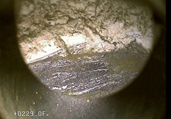
In CT 1, there is an ~ 6 ft cave (84 – 90 ft below surface), and in CT 3, there is an ~ 7 ft cave (125 – 132 ft below surface). These features suggest this area may be a karst aquifer system.
In CT 1, there is an ~ 6 ft cave (84 – 90 ft below surface), and in CT 3, there is an ~ 7 ft cave (125 – 132 ft below surface). These features suggest this area may be a karst aquifer system.
